The Annapurna Circuit Trek stands as one of Nepal’s most celebrated trekking adventures, weaving through diverse landscapes, cultural landmarks, and Himalayan panoramas. No wonder the Annapurna Circuit Trek Map is one of the most searched maps on the web. With its majestic beauty and rich experiences, this trek demands careful planning, and a reliable map of Annapurna Circuit Trek becomes your indispensable companion for the journey.
Renowned for its unparalleled diversity, the Annapurna Circuit Trek takes you from subtropical forests to high-altitude tundra, with dramatic Himalayan backdrops. Crossing the famed Thorong La Pass (5,416m) and visiting sacred sites like Muktinath Temple are just a few highlights. Along the way, you’ll encounter warm local hospitality in villages such as Chame, Pisang, and Manang while enjoying views of Annapurna, Dhaulagiri, and Manaslu peaks.
Now, let’s take a detailed look and discover the Annapurna Circuit Trek map with detailed routes, key stops, and stunning views for your adventure.
The Classic Annapurna Circuit Route
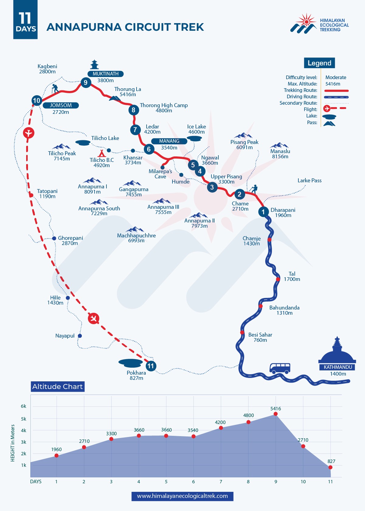
Traditionally, the journey starts from Kathmandu and the actual ACT trek begins from Besisahar, and journeys through Bhulbhule, Chame, Pisang, Manang, Yak Kharka, and Thorong Phedi before ascending the Thorong La Pass. However, due to road accessibility and routes, there are many variations of Annapurna Circuit Trek. After crossing the pass, trekkers descend to Muktinath, passing Jomsom and Marpha, with the option to unwind in the hot springs of Tatopani. Some trekkers extend their route to include the Ghorepani Poon Hill trek or the Annapurna Base Camp trek.
Understanding the Route
- Starting Point: Besisahar (760m)/ Chame
- Highest Point: Thorong La Pass (5,416m)
- Ending Point: Muktinath/ Jomsom to Pokhara
- Total Distance: Approximately 160-230 km (depending on where you start/end)
Highlights of the Annapurna Circuit Trek map:
- Dramatic Altitude Range: Journey from Besisahar (760m) to Thorong La Pass (5,416m), showcasing incredible elevation diversity
- Cultural Heritage Sites: Experience rich Gurung and Thakali cultural traditions along the route
- Sacred Landmarks: Visit important religious sites including the sacred Muktinath Temple.
- Strategic Rest Points: Key acclimatization stop at Manang (3,540m) for proper altitude adjustment.
- Diverse Landscapes: Trek through subtropical valleys to high-altitude Tibetan plateau terrain.
- Mountain Views: Spectacular vistas of peaks exceeding 8,000 meters in height.
- Teahouse Facilities: Well-established accommodation network with basic amenities and local cuisine.
- Seasonal Highlights: Spring offers rhododendron blooms and clear skies, while autumn provides stable weather and a festive atmosphere.
- Accessible Infrastructure: Wi-Fi availability in most areas and hot shower facilities throughout the route.
- Clear Route Progression: Well-marked path from Kathmandu through key points like Besisahar, Manang, Thorong La Pass, and ending in Pokhara.
Evolving Routes: Why Has the Annapurna Circuit Shortened?
The construction of motorable roads has transformed the Annapurna region. While this development benefits local communities by connecting remote areas, it shortens trekking routes. Many trekkers now opt to begin at Chame. Some trekkers choose to complete other high-altitude routes before beginning their journey from Manang. However, starting at higher elevations increases the risk of altitude sickness. Himalayan Ecological Trekking prioritizes your safety by encouraging gradual acclimatization and providing updated maps to guide your adventure responsibly.
Enhance Your Journey with Tilicho Lake
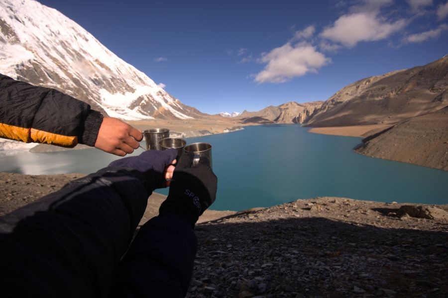
Annapurna Circuit Trek can also be combined with the classic Tilicho Lake trek, one of the world’s highest-altitude lakes, which is a breathtaking addition to the Annapurna Circuit. The trail diverges at Manang, leading to this serene destination before reconnecting at Yak Kharka. Adding Tilicho Lake requires approximately four extra days, but it rewards trekkers with unmatched tranquillity and unforgettable views. Our detailed maps ensure you navigate this detour with ease.
Trusting Your Annapurna Circuit Trek Map
Himalayan Ecological Trekking provides updated physical maps to every trekker that reflect the latest changes, such as new roads and alternative trails. While trekking with a guide enhances safety and local insight, a reliable map empowers you to explore independently and confidently.
Hidden Gems: Nar Phu Valley and Beyond
The Annapurna Circuit Trek Map by Himalayan Ecological Trekking offers more than just the main trail. It includes information on side treks like the Nar Phu Valley, where you can experience ancient Tibetan culture and stunning landscapes. Additional routes to Annapurna Base Camp, Mardi Himal, and Ghorepani Poon Hill are also marked, giving you the flexibility to customize your trekking experience.
High-Altitude Cycling on the Annapurna Circuit
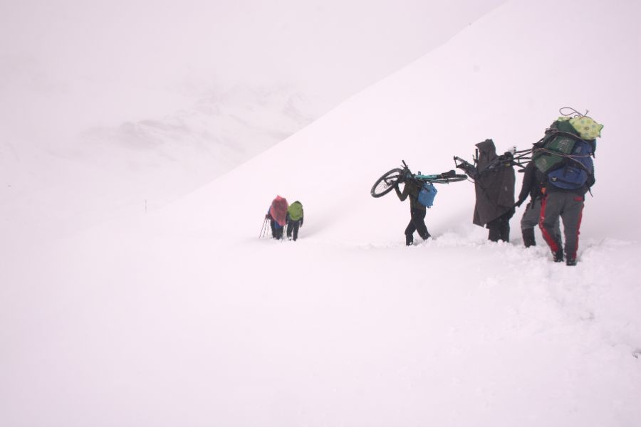
Adventure seekers can also explore the Annapurna Circuit on two wheels. High-altitude mountain biking is growing in popularity along these trails. While certain sections, like Thorong La Pass, may require cyclists to carry their bikes, most of the route offers a thrilling challenge. Specialized cycling maps highlight alternative paths to avoid steep ascents and descents.
Navigation Tips
- Follow the ACAP (Annapurna Conservation Area Project) markers
- Use GPS tracking apps as a backup
- Stay on marked trails
- Check weather conditions daily
Safety Tips
- Acclimatize properly, especially in Manang
- Carry detailed maps and a compass
- Trek with a licensed guide
- Register with TIMS (Trekkers' Information Management System)
Remember that weather conditions can significantly impact your trek, so always be prepared to adjust your itinerary accordingly. The Annapurna Circuit offers one of the most diverse trekking experiences in Nepal, combining natural beauty with cultural richness.
Maps route maps published by Himalayan Ecological Trekking are curated with the expertise of seasoned guides and updated data. Post-2024 maps include new trekking routes and accurate depictions of motorable roads. These maps not only assist in navigation but also provide tips on accommodations, attractions, and altitudes to ensure a seamless journey.
Plan Your Annapurna Circuit Trek with Himalayan Ecological Trekking
A reliable map is more than a navigation tool—it’s your key to a memorable adventure. Whether you’re trekking the classical route, visiting Tilicho Lake, or exploring hidden trails like Nar Phu Valley, a detailed Annapurna Circuit Trek Map from Himalayan Ecological Trekking ensures safety and success.
Contact us today to receive your Annapurna Circuit Trek Map and let Himalayan Ecological Trekking guide you through one of Nepal’s most iconic trekking experiences!
